
I keep thinking I’d like to go visit Croft State Park in the summer time, but before I know it, here it is the end of Autumn. Oh well, I’ll take what I can get.
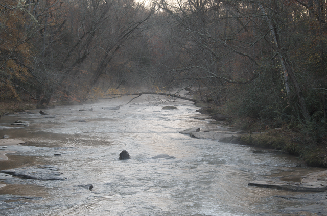
I got off to a nice early start, taking full advantage of my favorite time of day. First stop, Fairforest Creek:
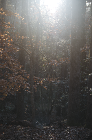
Yup, sunrise in the forest. It’s a beautiful thing.
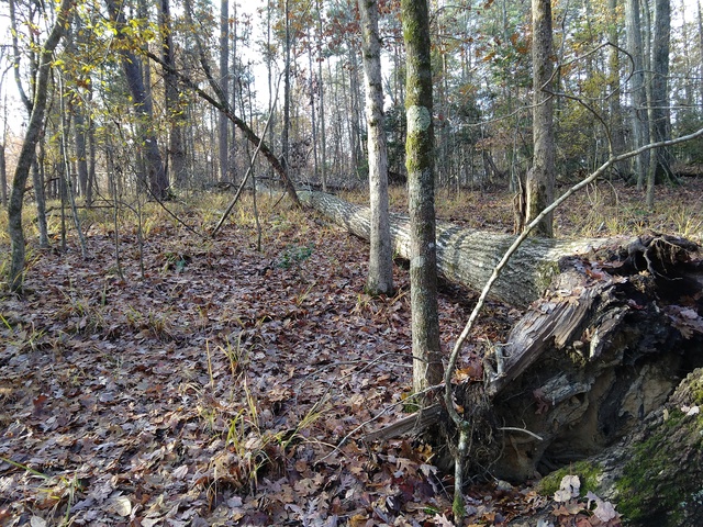
Even if a tree is laying down, it still looks tall.
Last time I crossed the creek here on the Johnson Lake Fairforest Creek Connector trail, things were dryer and I was able to just hop across on the rocks.
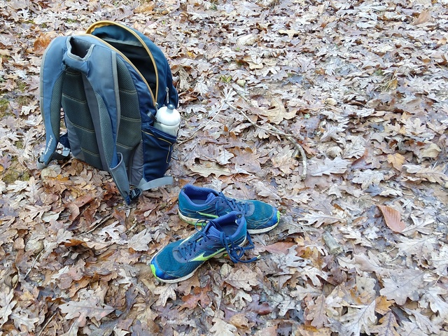
This time it was a bit different, with some recent rains. I didn’t want to get my shoes wet. It’s interesting that with a nice diverse mix of trees, the leaves on the ground are similarly diverse.
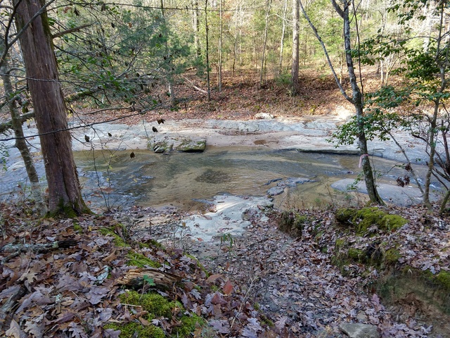
Last time I went through here I missed where the trail turned to cross the creek and ended up following an unmapped trail for a ways. This time I was wary, but there were also much clearer markings. I’d like to think that was in response to my report last time.
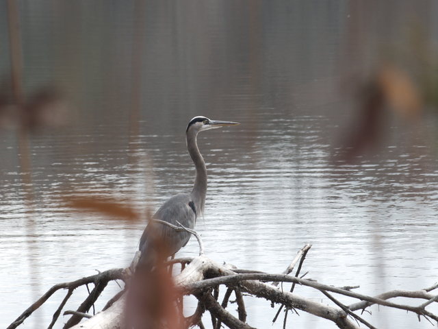
I had stopped along side Lake Johnson to get some pictures of the geese out on the lake. I was thinking, gee, I don’t see any Herons, I might not get my “obligatory Great Blue Heron” picture. Then I moved a little to one side, and, Holy Zarquon’s Singing Fish! There was a Heron right there on a tree that had fallen into the water.
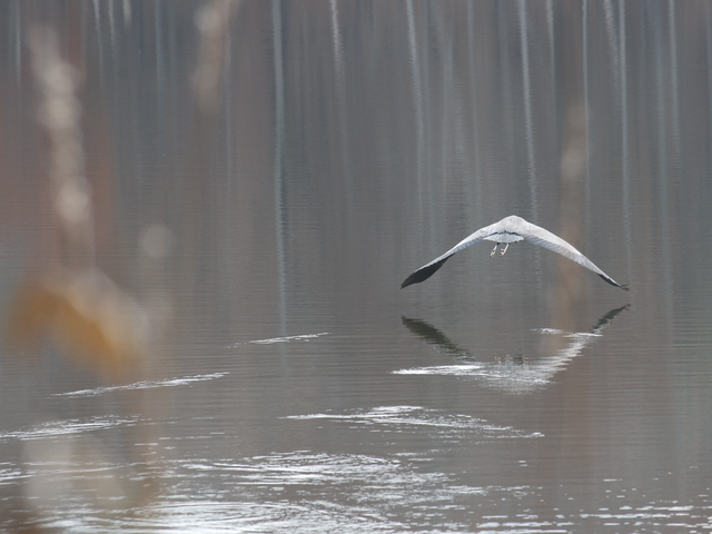
He seemed OK with my being there, but then a couple humans came walking along the trail and that was probably a bit too much, and off she went. I don’t think the wings were actually touching the water, the ripples trailing back are probably from the downwash.
Oh yeah, here’s a couple of those Canada Geese:
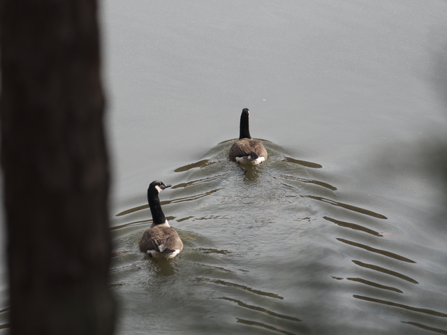
Interesting how most of my wildlife pictures show the wildlife heading away.
I had one little misadventure. I was following the Lake Johnson trail south along the east side of the lake, looking for the Lake Johnson Loop trail where I would turn east. Somehow I missed that. I remember crossing a path, but nothing triggered me to say “ah, trail”, and the trail I was following kept going south. So I kept going. As long as I had Lake Johnson on the right and I was going south, I about had to get where I was going.
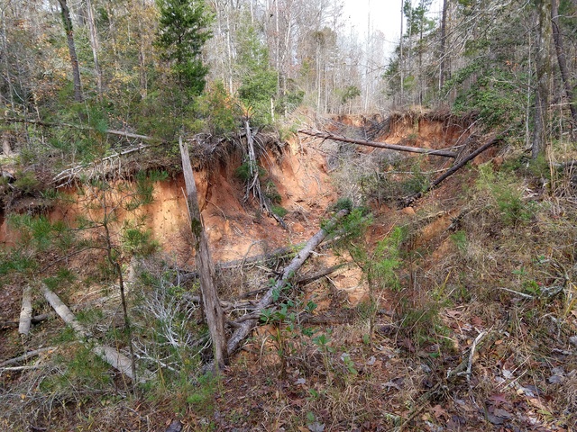
Now that’s what you call Erosion. Not sure what caused this, as there wasn’t really any indication of water flow.
After a while, I was really wondering where that loop trail was. It was a good spot to stop for another lunch, and, sigh, I decided to see what my phone could tell me. I was now just east of Lake Craig, a good mile+ south of where I should have turned. I considered backtracking, but according to the trail map, the Foster Mill Loop trail should be just a proverbial stone’s throw to the east, and the trail was turning in that direction anyway. I figured it’d be worth 15 minutes or so to see if that would play out, so I continued on (“The best way out is always through” – Robert Frost).
As soon as I set off, I passed a sign on a tree facing the other way. I turned to see that it said “this isn’t a real trail, you really really should go back” (or words to that effect). Ok, I did a 360 [degree turn] to go back the way I was already heading. That sign was actually encouraging, since if people might wander there from the opposite direction, I was probably close to a published trail. Turns out I was right, it wasn’t but 5 minutes before I met up with the Foster Mill Loop and Beech Tree trails.
I spoke with a Park Ranger about it since, even though I’m no master woodsman, if I could miss the turn, someone else could, and she took the report so the signage at that intersection could be improved. She said there are a lot of these “rogue” trails around the park, and added that they were expecting the Army Corps of Engineers to be out there next year to clear some of the western end (the park used to be an army training base during WWII, so there could be Dangerous Things laying around) and maybe open up some of the “rogue” trails in that area.
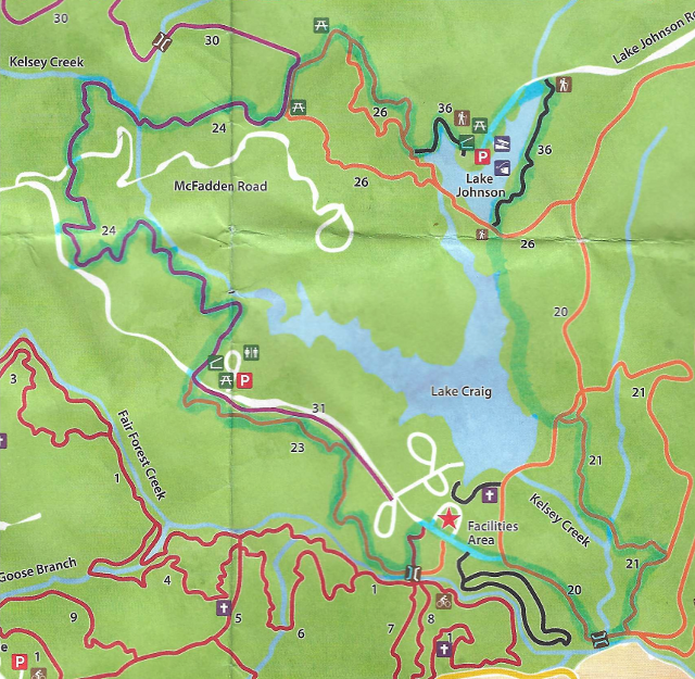
From my somewhat-abused and highlighted-after-the-fact trail map:
I didn’t bother trying to create a GPS track, due to power requirements and with all the twists and turns, a GPS distance wouldn’t be terribly accurate. I’d guess, however, from published trail lengths, that was about 12-13 miles.